


Guest author: Maurice Frank
——————————-) = (——————————-
What does a mountain, a brochure, and a printer-scanner have in common? Usually not much, but during the Covid lockdown of 2020 they each became the focus of a project that helped me stay busy and somewhat sane.
Prior to the great pause in our lives, I happily led a very active retired life engaging frequently in numerous groups and events, sports, entertainment, and get-togethers with friends. I often felt too busy and wished for more time. Well, as the saying goes, be careful what you wish for. In March 2020 I suddenly found myself with an abrupt end to my days full of four to six events. I had all the time I wished for. Now, what can I do?
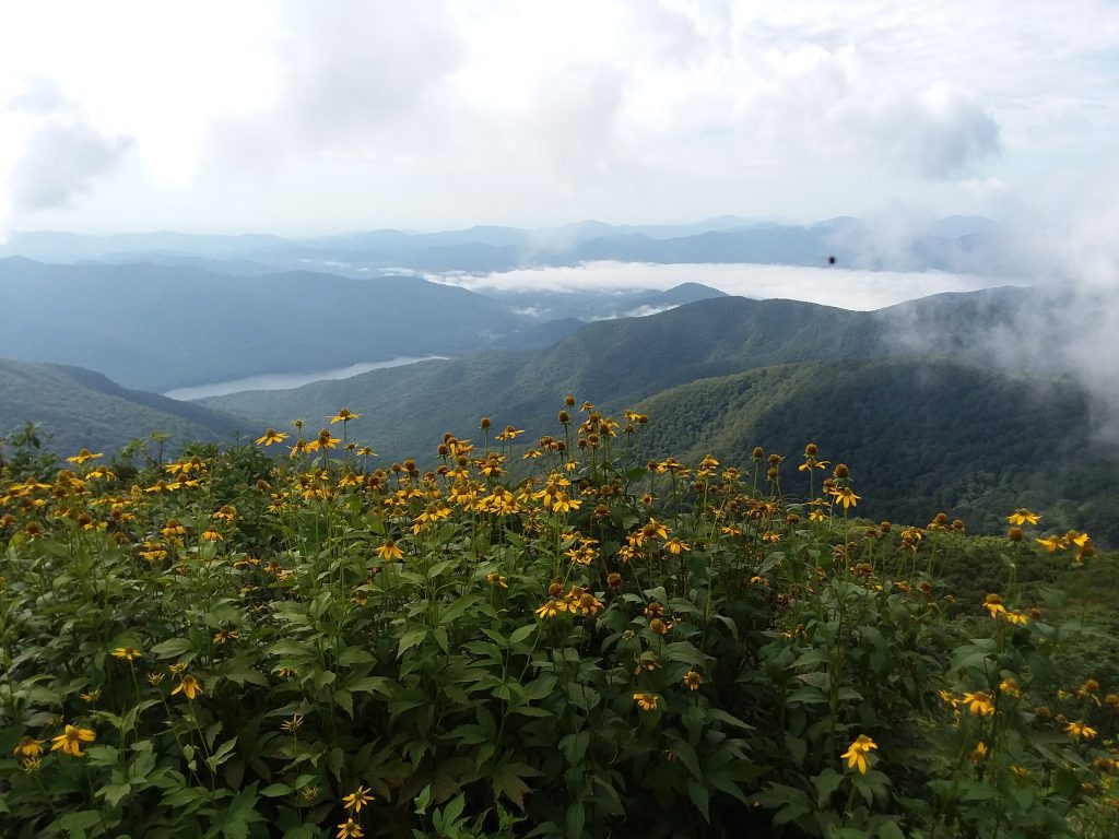
I’m fortunate to have a mountain just behind my community. It’s called Scott’s Mountain. I wish I could meet Scott so I could thank him for putting his mountain so close to my home. I can walk out my door, around the block, and at the end of a street is a trailhead which takes me to a section of the Pisgah National Forest next to Scott’s Mountain. A complex network of trails connects these two areas. During lockdown, hiking was a safe activity. Before Covid I rarely or never hiked alone, but solo wandering became my norm.
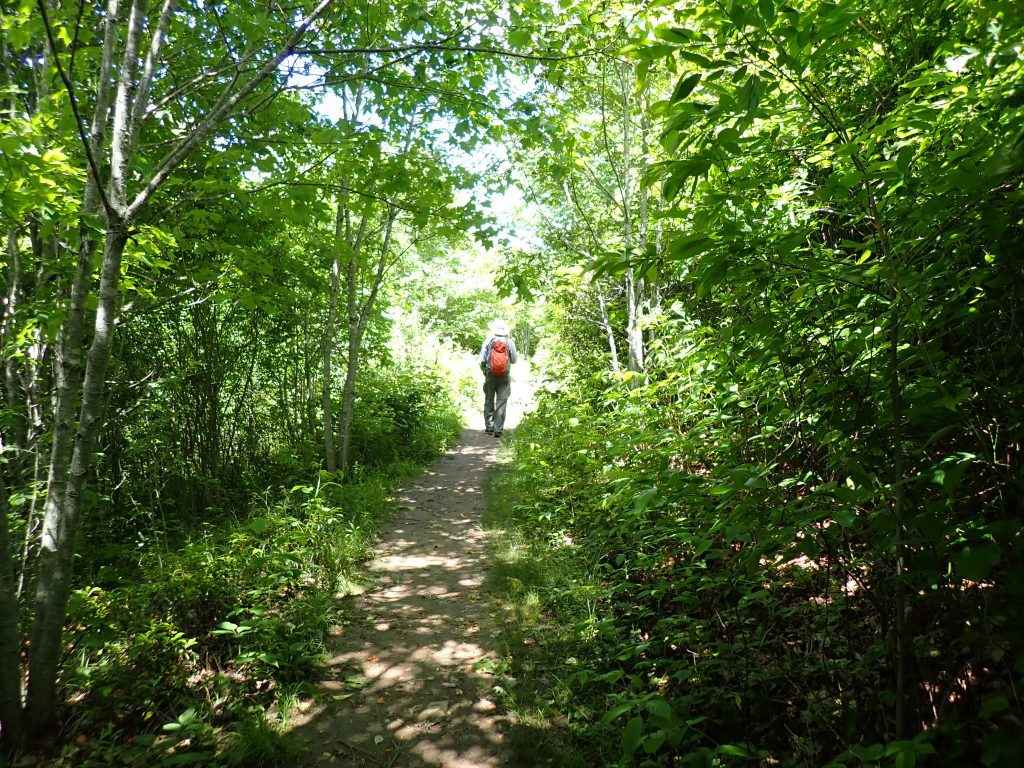
Some of the trails appear in hiking apps and on public maps. Most of the apps get their trails from a site called Open Street Maps, which is crowd-sourced. Prior to lockdown, when I hiked the main ridge trail on Scott’s Mountain, I noticed many side trails veering off the main trail. My curiosity was aroused: where did they lead? My hiking apps didn’t show these trails, so I was wary of following them. But with time to fill, I started exploring these mysterious paths. I always activated the tracking feature in Gaia GPS, my favorite hiking app. After tracking a few trails, I noticed that Gaia GPS very nicely displayed all the tracks I saved in the area, and each track has a different color. I realized my homemade map was much more complete than the public maps. I spent months following every unmapped trail and adding them to my personal map.
I started noticing that other areas I hiked in were either completely unmapped (the trails in the woods on the north end of the UNCA campus), or the area was partially mapped – some trails were known, others were not on the official map (Bent Creek, also known as land of a bazillion side trails). Knowing I could map other areas led to an aha moment when I realized I now had an actual hobby.
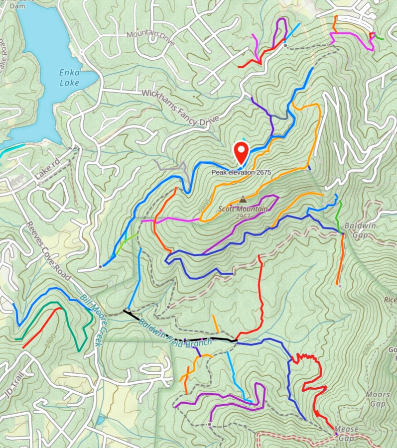
One lesson I learned from this mapping project is that I’m reluctant to say I actually found and documented every trail in an area. Once I followed a side trail off the main forest road #5096 in the Pisgah National Forest and the trail just dead ended in the woods. A few months later I passed the trailhead again and something compelled me to follow it one more time. At some point I knew I was past the original dead end, and not long after that I reached a junction with a more distant point on the forest road. Apparently, I found a half-built trail that was now completed. Who made this? I can’t be sure, but I believe it is the mountain bikers.
Speaking of hiking, one day while aimlessly moving papers around on my desk I uncovered a small brochure titled “30 Hikes on the MST in Asheville” which I originally obtained from the Blue Ridge Parkway Visitor Center. I had hiked some of these 30 hikes on the Mountains to Sea Trail (MST), but not all. So, with time to fill and boots to wear out, I committed to doing every hike in the brochure. This stretched from Mount Pisgah in the west to Mount Mitchell in the east. Each hike description indicated where to park, the distance between the starting and ending points, and a rating of easy, moderate or strenuous. If it says strenuous you can believe it. Easy is feet and legs of the beholder, and moderate is actually quite vague. Bring extra water.
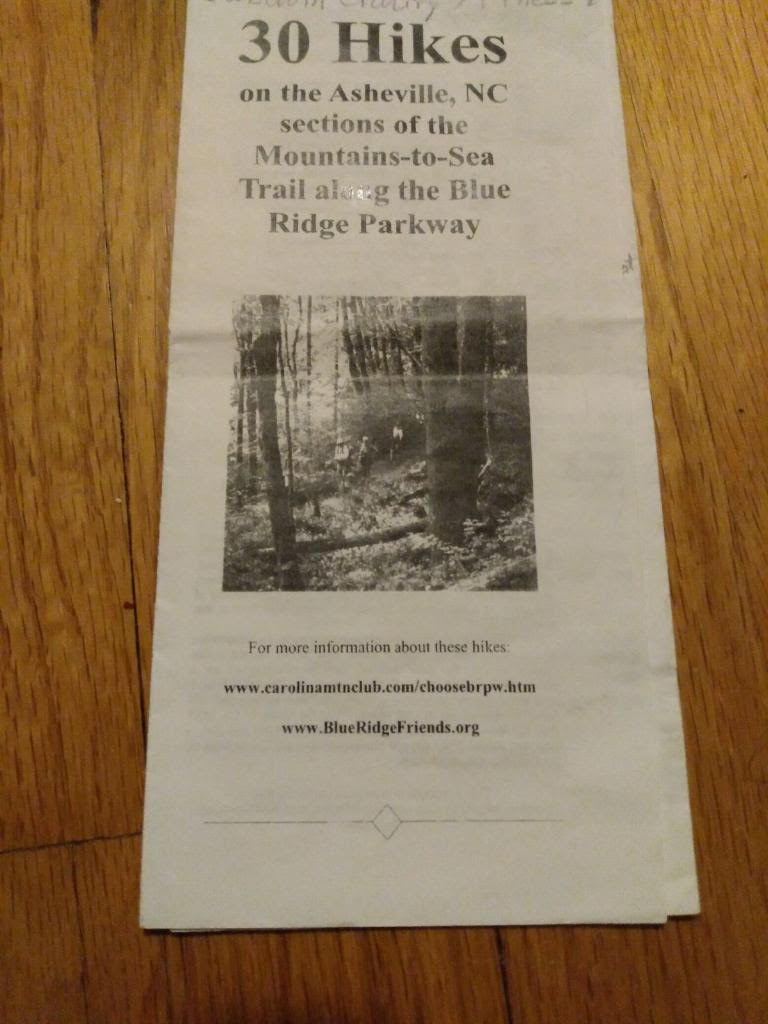
I began by accessing the MST from the Brevard Road entrance to Blue Ridge Parkway where you can also find the NC Arboretum entrance. I started hiking west towards Mount Pisgah and usually completed one or two of the 30 hikes, depending on distance, difficulty and how eager I was to get back home to watch another episode of Monty Python or The Good Place. My hikes were out and back, so I actually hiked double the distance noted for each hike. I usually did two or three hikes a week, and within a few weeks I summited Mount Pisgah completing the western hikes. I then started hiking eastward from Brevard Road, also doing each hike out and back, until I finally gazed down from Mount Mitchell. The 30 hikes totaled 65 miles end to end, and my out and back hikes doubled that distance to 130 miles.
You have to be of a certain age to know that there was an era before smartphone or even camera-based digital photography. Historians can confirm this fact. A more tangible proof was several boxes of well-organized photo albums and a few more boxes of loose totally unorganized photos hibernating in our closets. Some photos dated back to the 1980s, which is about when today’s middle-aged people were just being born.
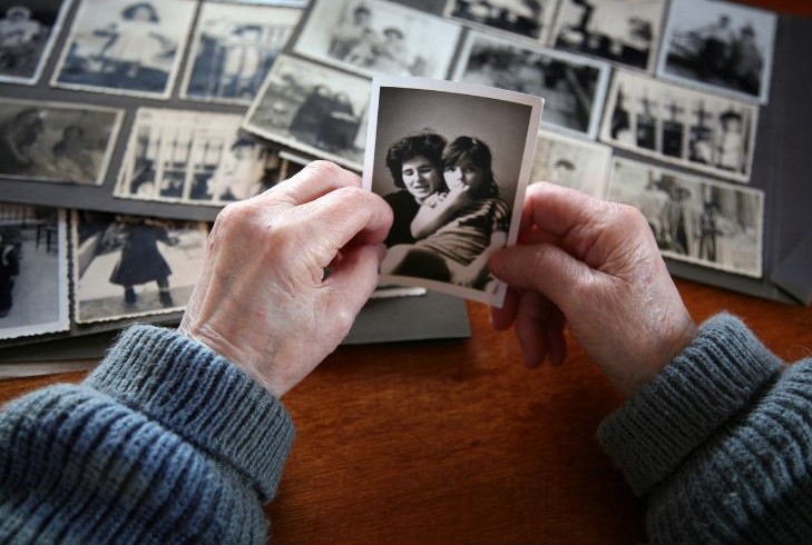
In that bygone era, cameras stored photos on plasticky film. When the film was full, you took it to a drug store which soon returned a envelop full of small paper-based photographs. You could frame these photos, or put them in large binders to create albums. Later, when digital photography made film obsolete, cameras stored photos on data cards with capacities almost as large a very short YouTube video. You could print these photos yourself, or have them printed for you by a service, or just copy them to your computer where they could rest unseen for years.
My wife Wendy is an excellent photographer who delighted in documenting our vacations, parties and family events on film or digital. She diligently had the film developed and the photos printed, then she neatly organized photos into well-labeled albums. When we moved to Asheville, we brought along several large boxes full of albums which spent a few quiet years stored in a closet. I came across them one day during lockdown and I had the bright (synonym for not well thought out) idea to scan the photos so we could discard the physical binders thus reducing our closet clutter.

Not truly grasping the scale of the little project I initiated, I started placing photos on the flatbed of my printer, and I let the scanning software hum along while it turned the image to bits. A typical album could have 20-40 photos, so this effectively kept me busy for hours. One day, the former computer programmer in my brain pondered what would happen if I placed multiple photos on the printer’s glassy surface. I tried it. I clicked scan. I wondered. I waited. Suddenly, instead of one image on the scanning software screen, I saw three separate rectangles containing a photo image. OK, now what happens if I hit save? I was then astonished and delighted to discover that the software saved three separate photo files and distinguished them by adding a numeric suffix to each file name. Suddenly, this massive project started moving along not at light speed, but 3-5 times faster than before. Older smaller photos fit 5 at a time on the scanner, and even the larger photos fit 3 each time.
Fast forward several months and my hard disk was the happy home of over 8,000 digitized photos. I even scoured the house for framed photos and scanned them. When I was done every printed photo I could find has its digital doppelganger neatly organized on the computer.
The most perplexing part of this projects was actually looking at the photos they were scanned and saved. Fortunately, Wendy labeled every album so there should not have been any doubt about what they were. Yet I constantly found myself looking at a vacation album where I spent a full week of my life, albeit a few decades ago, and I had zero recollection of every doing it. And photos of ancient Halloween parties were full of then friends who I had no idea who they were or how I once knew them.
A brochure full of hikes, a surprising emergence of a new hobby mapping hiking trails, and a computer full of old photos were three time-consuming projects that helped me slog through the long homebound days of 2020.
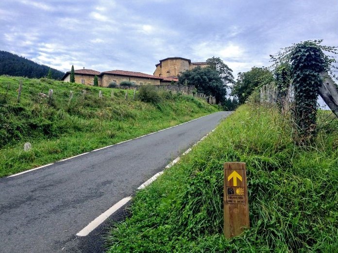
Ethel note: Maurice has parlayed all those hikes into his training regimen for El Camino de Santiago, a 500 mile pilgrimage/hike from France across northern Spain to Santiago de Compostela, the assumed resting place of St. James. He’s over there now, no doubt mapping out his proposed trails and getting ready for the starting line. We wish him un buen Camino! We should expect a future guest blog along with some great photos.
Quote of the week is small, but powerful!
I loved reading this and I did sign up for the penguin apps that I could follow Maurice’s track.
Yes, we will also be following Maurice on his journey!
You fooled me! I thought I was reading an Ethyl post until the reference to “my wife Wendy.” I love the topics: hiking near Asheville and digitizing old photos. I was an ambitious hiker in the mountains until I unexpectedly noticed a nearby black bear eyeing me. Luckily it wasn’t really interested in me, but I’ve been significantly less adventurous since.
I’ve digitized a hoard of old and new family and vacation photos. Now they all cycle through my computer’s screensaver program reminding me of people and events that often bring a smile and warm my heart.
Ha…Of course, she is the very good photographer and lovely wife of Maurice. We have yet to see a bear while hiking, but we have a plan should that occur, which mostly involves who gets to pick up our crazy dog and hightail it out of there!
I need to figure out how to get my old photos digitized. Thx
Well, I would pay someone to do it for me! Just saying.
I just scanned multiple photos, depending on their size, at a time. Then I digitally cut and saved each photo individually. It was a lengthy process, but also a labor of love. For some photos in old scrapbooks, I just scanned the whole page, or as much of it as would fit on my scanner.
Thanks. I need a “round tuit.”
Hard to catch hold of these days!
I will give it a try! Thanks!