


Carol H.’s Review: The clearest way into the universe is through a forest wilderness. —John Muir
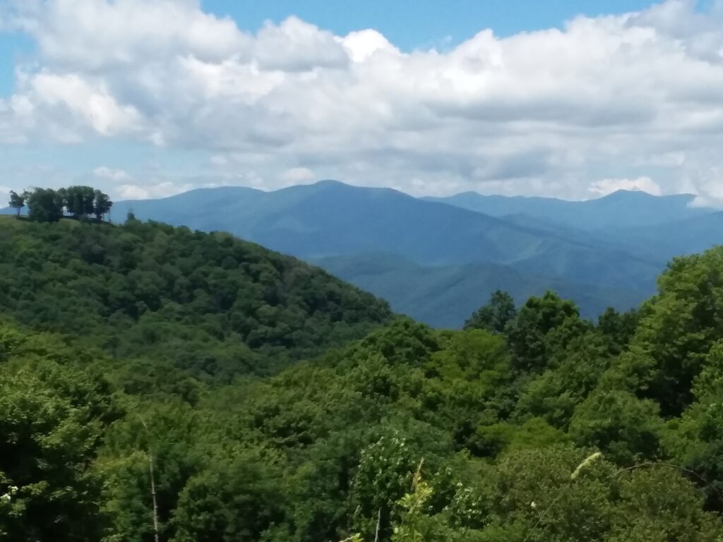
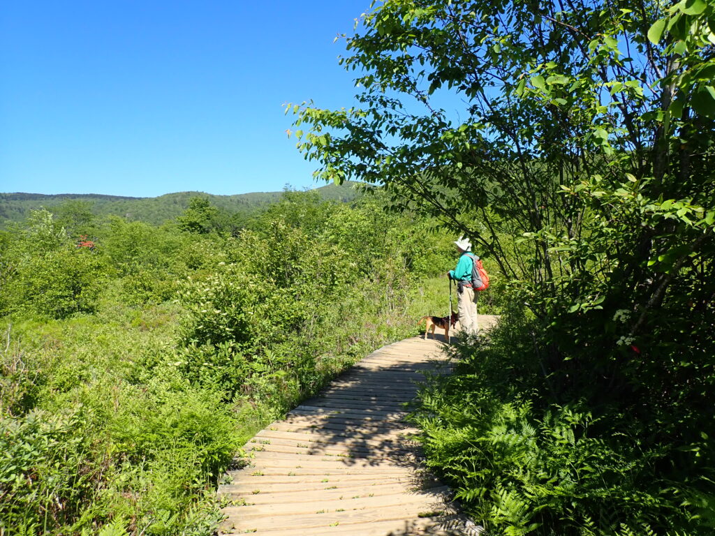
Always a view!While recently hiking at Graveyard Fields (a name with ominous undertones), my husband/hiking partner stopped at a spot where two roads diverged in the yellow woods. He asked, “Judging by what you see here, which way would you take?” Oh no, a test! He was ruining my Robert Frost moment. Always up for a redundant challenge (because I knew he would eventually tell me which way to go), I carefully studied the two ways forward. One trail crossed a creek and continued at a similar level of altitude. The other ran alongside the creek and seemed to have an upward trajectory. I thought this over and pointed upward since we were heading toward a place called Upper Falls and right there in front of us was some rather obvious water. I felt confident in my selection.
My track record for going the wrong way in the woods remained intact. The man with the question stepped aside to reveal an arrow of stones on the ground pointing in the other direction. Unfair. But truthfully, I would have gone my way despite the arrow. I wondered at this point why the people who maintain these hiking areas had not placed more official signage at these junctures for those of us who would roam about in the woods for hours having stumbled off our intended trajectory? We heard stories that day from some of the people who had chosen the wrong direction and never found the falls but had a lovely hike up to a ridge. We turned left and crossed the creek (apparently it was not the creek we were ultimately seeking).
Be Prepared!My pathfinding skills are based on decades of city living. I can read a road map and generally know which direction I am traveling in the city or on a well-marked highway. Throw some trees in my way and I am reduced to checking for moss on tree trunks and hopelessly guessing a direction relative to the position of the sun. The latter works best at dusk and dawn, but is a deplorably inaccurate system at 11 am on a cloudy day. Even with a map, I use up quite a bit of daylight just deciding where I am on the map, landmarks being ambiguous among the many trees, let alone deciding which way to move forward.
I am what might be called “map dependent.” When I first moved to Asheville, I was so bewildered by the cockamamie maze of streets this city had to offer for getting from A to B, I needed to purchase a street map of the city. This was not an easy task. In the pre-GPS era you could walk into any gas station and buy a map of the local area. Now you can purchase a bag of Flaming Hot Cheetos, a questionable burrito, a package of cigarettes and a quart of motor oil at the local Shell Station, but good luck finding a map of the city in which you find yourself. I had to order mine online. It cost me $18.
I have a built-in NAV system in my fancy new car. I also own a portable GPS, which is so user-friendly I like to take it to bars with me and buy it a glass of wine. I have the Google Maps app on my phone and am able to download Waze in a pinch. In a car, my “I’M LOST” paranoia is assuaged by the many systems at my disposal, except when making my way through Weaverville—a town which defies all path-finding apps. I can get from home to just about anywhere with technical assistance, but that doesn’t mean I know where I am. Enter the MAP.
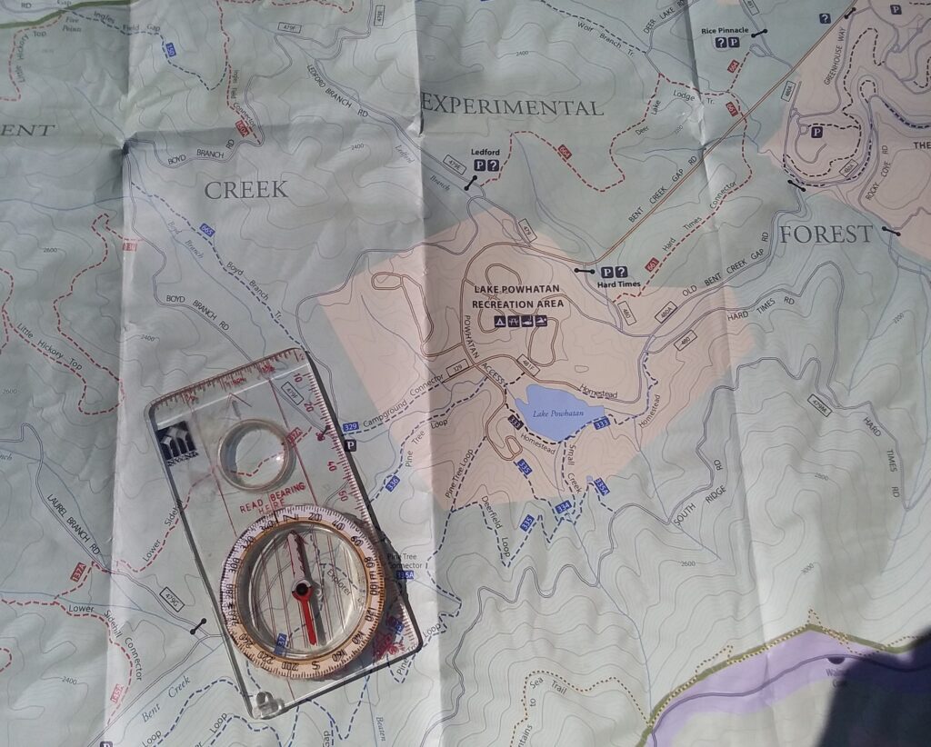
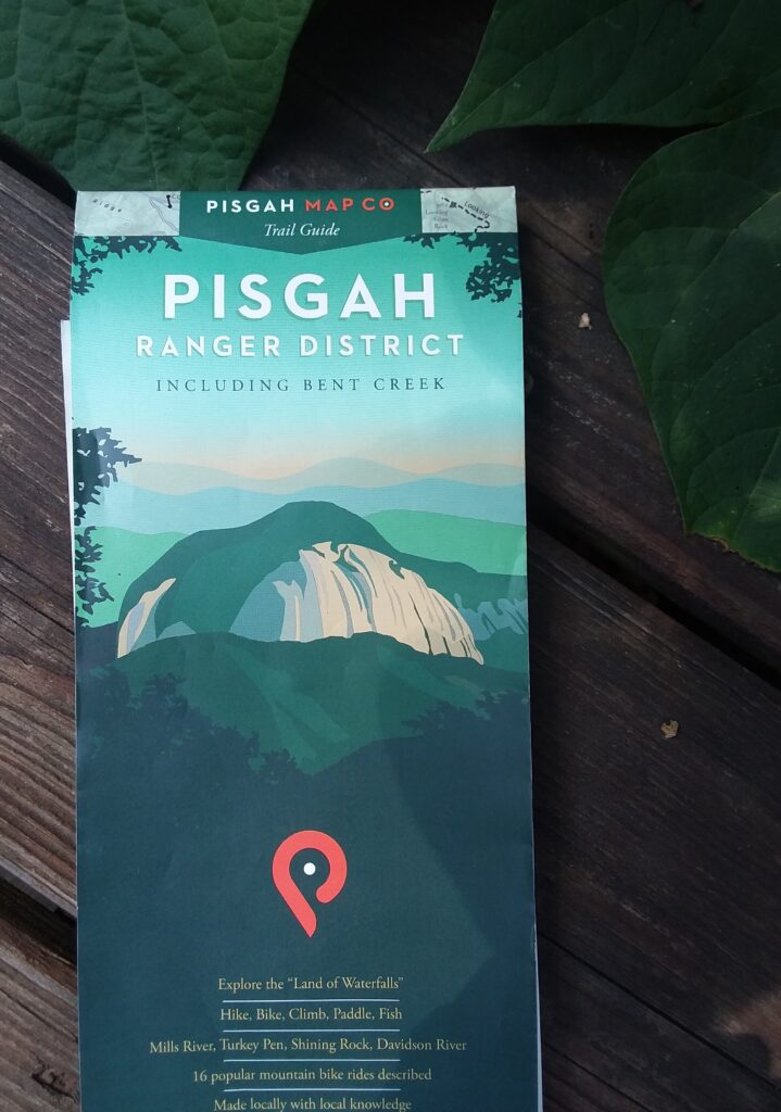
A compass is helpful!The MAP is an antiquated device which gives you a sense of relationship between the places you go. Whenever I methodically follow the directions on the GPS in order to arrive safely at an intended destination and back home again, I pull out the city map and follow the route I took so that I can orient myself to its geographical relationship to my house and other familiar places. Sometimes you can get a map of the trails for the more popular hiking spots, which not only leads you to that spectacular vista, but might also help you find your car again. Maybe.
On a recent hike with my pals Tee and Carol in the Bent Creek Recreational Area, a place I’ve been several times with my husband, we started our recreating from an overflow parking area. None of us brought a map. I’d been there before, so knew my way from the main parking lot, but not from this superfluous one. Never the less, I confidently lead the charge over a fallen tree and onto the path leading into the park. Then just as confidently insisted we turn onto another trail which led to the lake, except it didn’t. Thankfully Carol had a better sense of the place and pointed out the trail I wished to travel would take us to the main parking lot.
Graveyard FieldsAs a person who lives in Asheville, the very idea of a free parking lot with available spaces thrilled me to the core, as it is a local wonder one should visit just for the preciousness of its rarity. This lot, however, held no promise in the “available spaces” arena as this park is very popular with the locals. Probably because of the free parking. So, we shifted our attention to Carol’s superior sense of direction and skipped the side jaunt to the main parking lot, pressing onward in our search for the wide trail that went uphill. I continued to express my desire to turn this way, when in fact, we needed to turn the opposite direction. There were just too many trees to get my bearings—none of them had moss. Thankfully Tee was able to produce a trail map online when the route veered off in different directions and we had to make a decision. We were also able to find the car when we were ready to drive home, which is always a nice bonus.
Neither of my hiking companions seemed put out by my evident lack of trail skills. I always enjoy hiking with people who are willing to gently redirect me when I appear to be wandering off on a dubious detour. They are the ones who can distract me along the way, help me to enjoy the moment and then get back home safely.
Lower FallsMy husband is my primary, knowledgeable, trail-exploring buddy. The falls at Graveyard Fields, a leafy, steepish area off the Blue Ridge Parkway, are spectacular. Not Niagara showcase-able, but decidedly North Carolina nice. The Lower Falls, for those of us who often lose our way, are an easy find via a trail traveling along planked walkways and a series of staircases, well-marked by signage both directional and cautionary. By the way, rocks ARE slippery when wet. Families with small children congregate at the Lower Falls where the kiddies, with mountain goat-type athleticism, climb all over the wet rocks.
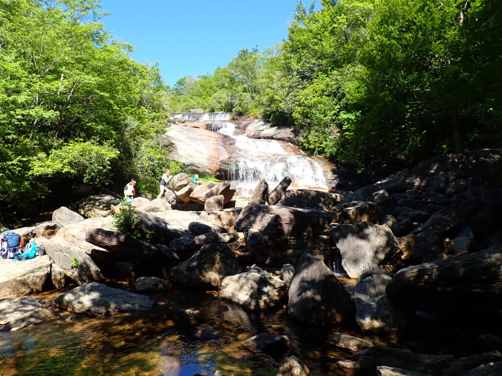
The climb to the Upper Falls requires a guide and an athletic trainer. Once I’d failed the “which-way-do-we-go” test, I prudently followed the guy who knows this stuff better than I do. As the trail became steeper and rockier and root-ier, all conditions which made the climb more hazardous, he stopped and said, “Listen.” We could hear rushing water. Even I knew that was a good, encouraging sign. By the time we encountered solid rock (i.e., boulders) we were rewarded with a misty vista of the bottom of the falls. We climbed as high as the foliage allowed without having to bushwhack our way any further, and settled ourselves next to the cascade for a scenic lunch break. Peanut butter and jelly never tasted so good. Even the dog was content to just sit and rest next to this well-earned delight.
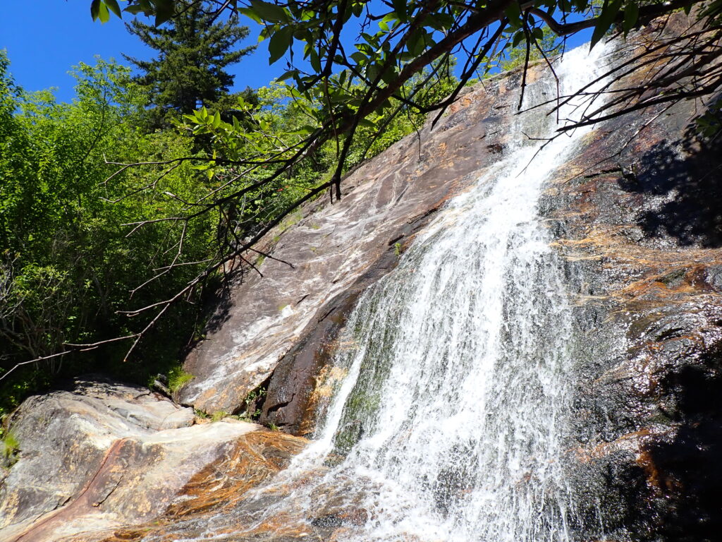
Our reward at the Upper FallsOn the way back to our car, we met several fellow-hikers. I helpfully explained where on the trail ahead they were going to have to defy instincts and turn left at the creek in order to find the Upper Falls area. Most seemed grateful to receive this information, though they may have been perfectly capable of following the rock arrow all on their own. I was determined to save them the trip up to the vastly inferior ridge. Without my guide, I’d probably still be traipsing around up there wondering what happened to the falls.
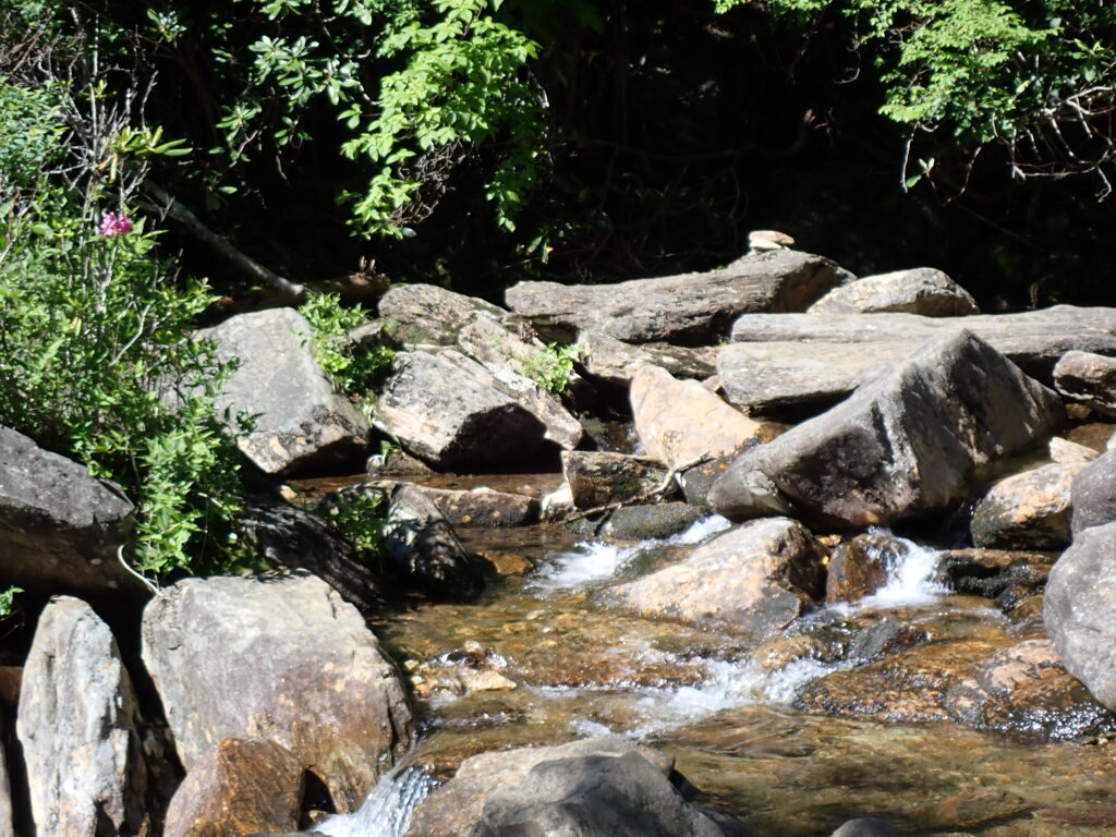
Resting spotAs we made our way back to the car, I considered my years of hiking with people who were talented at finding the paths which led to where we wanted to go without a lot of unnecessary wandering about. But, I confess, I like a little wandering. Not so much as to cause anxiety and park service rescue, but enough to add a little extra to the experience. Especially in a well-maintained park, where I’m bound to eventually run into a road or a volunteer maintenance crew. So, if you’re up for it, let’s get lost in the woods for a little while. You know the perfect place–where I still have reliable phone service and plenty of snacks.
Happy trails (bring some friends!)
Cheryl
I would hike with Guest Editor Carol H. any day. She is patient both on the trail and throughout the daunting task of editing my stories.
Ah! Hiking! I wish my back had been in better shape when we visited some place???? in Texas. We stayed at i-bar-u, right?
I think that was Enchanted Rock. You did very well. Did we climb to the top? I have pictures of that hike.
Only Bobby climbed to the top!! I gave a few pics too.
What a delightful read! Thank you.
Thank you Maurice!
This was lovely, and thanks for including the pictures. Made me a little wistful because my feet and legs are no longer up to this kind of hiking. But it is sweet to enjoy it vicariously.
I understand. I have to do lots of conditioning for my knees–they are the same age as me!
I’m always the slowest in my family, but I eventually make it.
I love this! As someone who shares your remarkable sense of (in)direction, I can relate all too well.
A hiking we will go! Let’s just bring some boy scouts with us!